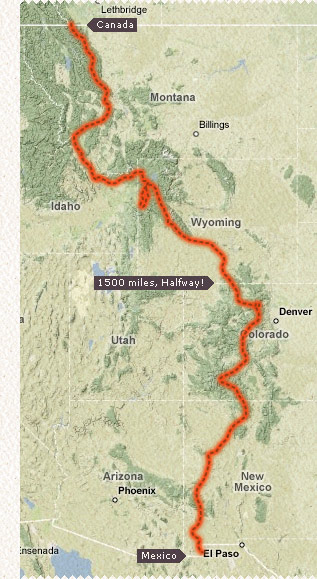
The Continental Divide Trail
The Continental Divide Trail or CDT is a 3100 mile wilderness trail that runs along The Rocky Mountain Range crossing 5 states, 25 National Forests, 4 National Parks and 3 Indian Reservations. Me and Paul Walked it in 2008 from May to October, we were unaided carrying all we needed to survive on our backs only leaving the trail to re-supply, take a shower and sink a few well deserved beers! We averaged about 20 miles a day, 6 days a week for a total of five and a half months, while tackling everything that Mother Nature had to throw at us including mountainous terrain, adverse weather conditions, water scarcity and not forgetting the rattle snakes and grizzly bears!! This is why only a handful of backpackers attempt this annually and even fewer finish in the same year.
Currently playing on this page is the 15 min version. It's reasonable short but long enough to give you a feeling for each state and generally in chronological order.
Click on the links below the video to swap between them, there's also some 'extras' linked up at the bottom of the page. They're all pretty big files because I didn't want to compress them too much. If you're having problems viewing them you could try downloading them over night here:
» 2 min version | 15 min version | 2 Hour version.
Well this video/documentary has taken me bloody ages to put together, the walk itself was so epic that I've found myself going over the top and putting in hundreds of hours of post production to do it justice... Hope you like it!
For those interested it was shot on a Sony HDR-SR12 camcorder, it's got a 120GB hard drive - which you need for a six month walk and it was edited with Final Cut.
